Information provided by Carroll County Sheriff’s Office EMA and the National Weather Service:
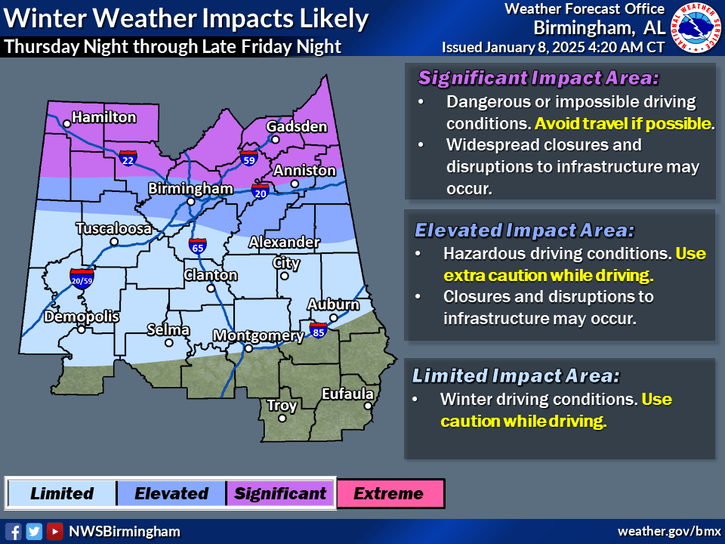
The National Weather Service has issued a Winter Storm Watch for parts of East Alabama and West Georgia, with a significant winter storm expected to bring snow, sleet, and freezing rain starting Thursday night. Here’s a breakdown of what to expect and how to prepare for the upcoming hazardous weather.

What to Expect
East Alabama
- Timing: From late Thursday night through Friday.
- Precipitation: A wintry mix with snow and sleet accumulations of 2 to 5 inches, with locally higher amounts possible.
West Georgia
- Timing: Beginning Friday morning and lasting through early Saturday morning.
- Precipitation: A mix of snow, sleet, freezing rain, and rain. Snow accumulations of 2 to 4 inches are possible, along with icing of up to a tenth of an inch in some areas, especially near the Interstate 20 corridor.
Impact on Travel and Safety Concerns
- Slippery Roads: Hazardous road conditions will develop quickly, making travel difficult.
- Bridges and Overpasses: These areas are particularly susceptible to icing, even if air temperatures hover slightly above freezing.
- Timing of Hazardous Conditions:
- In East Alabama, dangerous driving conditions could begin overnight on Thursday.
- In West Georgia, icy and snowy conditions will develop Friday morning and persist through early Saturday.
Stay Prepared
With any winter storm, small shifts in temperature or the storm’s track can significantly change the type and amount of precipitation you receive. Here are a few key preparation tips:
- Check Weather Updates Frequently: Stay tuned to reliable local forecasts and updates from the National Weather Service.
- Prepare Your Vehicle: Ensure your car is winter-ready with a full gas tank, emergency supplies, and proper tires.
- Plan for Power Outages: Freezing rain can lead to downed power lines. Have flashlights, extra batteries, and a supply of non-perishable food and water on hand.
- Avoid Non-Essential Travel: If conditions deteriorate, stay off the roads unless absolutely necessary.
Additional Updates Coming Soon
This forecast is subject to change, and even small temperature variations can have a significant impact on precipitation types. The next update from the National Weather Service will be issued this afternoon. Stay informed and take precautions to stay safe during this potential winter storm.
By being aware and prepared, you can navigate this winter weather safely. Keep an eye on weather alerts, stay warm, and take care!


