

FINAL UPDATE: 9.12.2024 – 530PM
For more current updates such as road closures, power outages, etc visit our friends at Newstalk1330 on Facebook
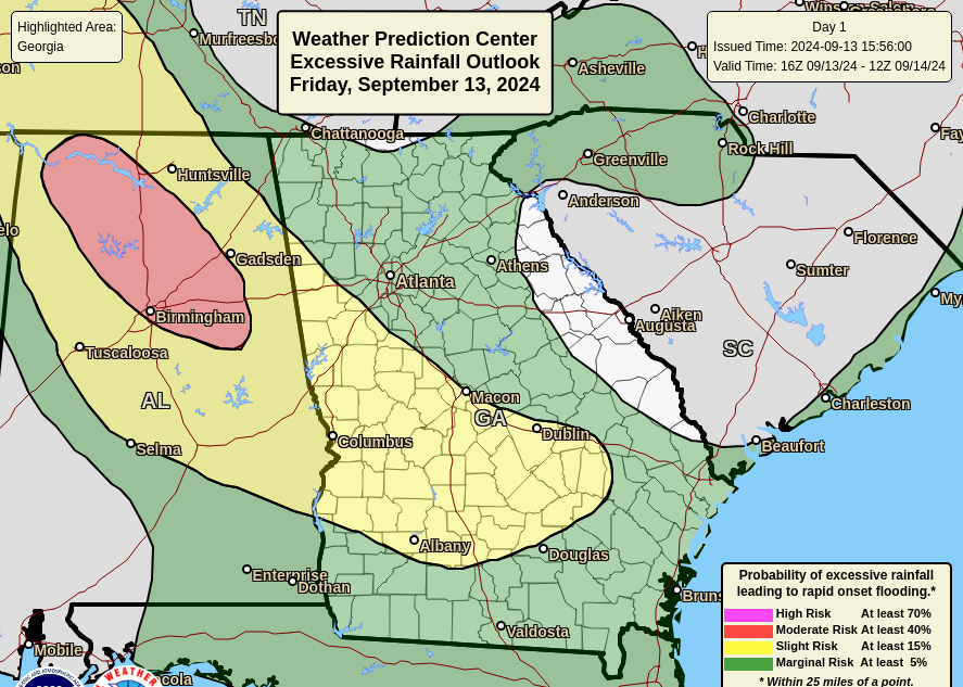
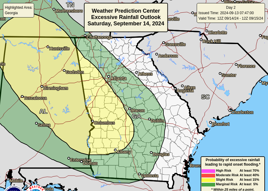
The remnants of Tropical Cyclone Francine will linger over the region through the weekend. This will drive continued shower and thunderstorm activity and a threat for localized flooding over primarily eastern Alabama and western Georgia. A Flood Watch remains in place for a portion of eastern Alabama and western Georgia where localized rainfall totals up to 4 inches may occur. The watch is in place through 8 AM Saturday, although we will consider the need for an extension tonight. Please note that we will not issue additional email updates for this event unless conditions are forecast to worsen over the weekend.
WHAT:
· A localized flash flood threat continues for portions of eastern Alabama and western Georgia.
· Rainfall Totals: 1 to 2 inches with isolated totals near 4 inches possible in eastern Alabama and western Georgia. Amounts should be significantly lighter in northeast Georgia.
· Rainfall Rates: Isolated rainfall rates in the 2 to 3 inch per hour range
· Multiple rounds of rain are possible, especially in eastern Alabama and western Georgia.
· Flooding will be most probable in the event that storms train over the same area.
WHERE & WHEN:
· Flood Risk: focused on eastern Alabama and western Georgia. The risk for flooding is highest this evening and tonight, but may linger through the day on Saturday.
· Rainfall: Possible statewide, with the highest totals in the western and central part of the state. Periods of rainfall will remain possible into early next week.
· Due to observed rainfall totals between 2 and 5 inches today, there is a slightly higher flooding threat near and south of Columbus.
IMPACTS:
· Localized Flash Flooding
· Significant river flooding is unlikely with this event.
FORECAST CONFIDENCE:
· Medium confidence in rainfall totals. Pockets of higher rain totals will occur anywhere that thunderstorms persist. While these conditions are probable somewhere within the watch area, our confidence in the timing or exact location is limited.
GRAPHICS:
Flood Watch:

Forecast Rainfall:
Flash Flood Risk through Tonight:
Flash Flood Risk Saturday:


